
Update from Lindsay Gee 09 Sept 2016 – LIVE ROV Ops on E/V Nautilus Research Vessel
It’s been a privilege to have the opportunity to participate in the latest Nautilus expedition mapping the Cascadia margin off the Pacific Northwest. The ship is a great platform for mapping and we covered over 5,000 sq. km with multibeam sonar and sub bottom profiler that will give scientists new insight to the structure and processes in the area. Over 50 new methane seep locations were discovered, from small single seeps to large clusters. It was exciting for me to be involved with the team acquiring and processing data in software from my former company, where I had contributed in getting the application out and onto ships like the Nautilus.
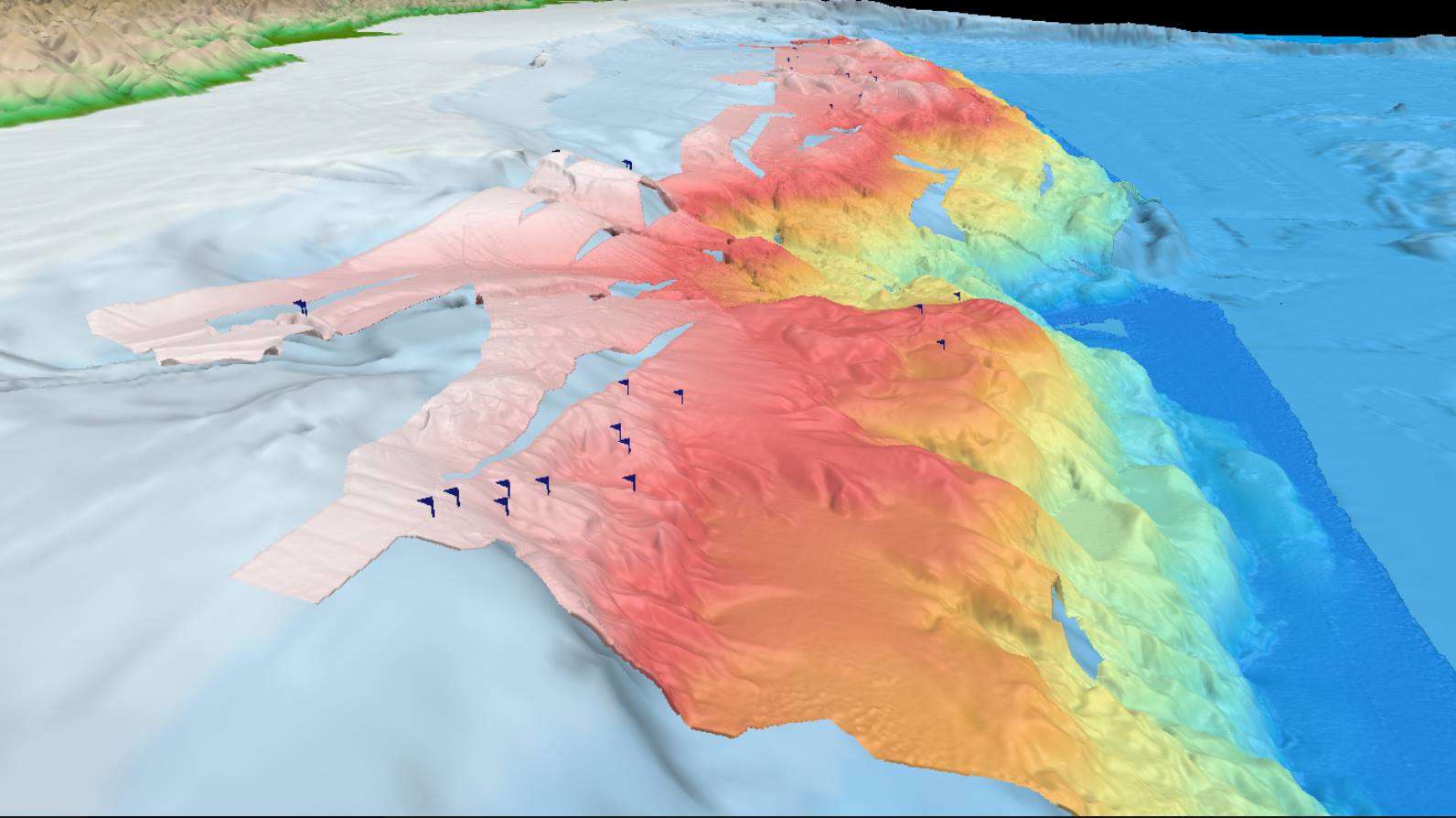
The photo shows results from the sound pulses we’ve been sending to the seafloor, calculating depth from the time it takes for pings to return to the ship. This multibeam sonar mapping allows us to create accurate bathymetric maps and even detect plumes from seafloor seeps – marked with flags.
Follow the Nautilus on Facebook.
Back to News list