
Case Example of Improvements Associated with Reprocessing Positioning and Orientation Data in Survey Areas where Satellite Blockage Occurs
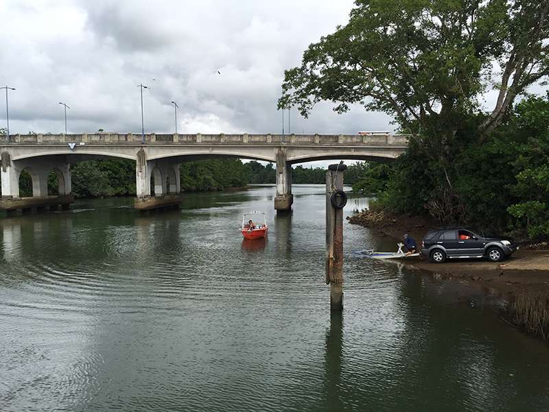
One of the technical difficulties associated with surveying under and around structures like bridges or in rivers with overhanging trees is the blockage of satellite signals at the GNSS antennas. The loss of satellite signals causes substantial degradation of horizontal and vertical accuracies even with Inertial Navigation Systems like the POS MV.
The figure below shows the “raw” positioning data associated with the North Johnstone River survey. Horizontal and vertical position accuracy degrades when passing under the bridge or when surveying around the piles (or when blockage occurs from trees overhanging the river). Good real-time position accuracy is around 0.5 metres but this can worsen to around 5m where blockage occurs.

The loss of satellite signal is illustrated in the figure below. Each of the red crosses in the figure represents a cycle slip (failure to lock on and measure angle / range) in a particular satellite.

Proper planning of a survey can minimise the positioning degradation through:
• Logging of the raw positioning and orientation data and
• Using base stations in the region as navigation aids.
The base station data may be part of a public or private regional network. Although such networks may be sparse in remote regions of Australia the infrastructure continues to improve year-by-year. For this data set the base station was part of a CORS network and the raw data was downloaded to assist reprocessing efforts, allowing correction of the missing satellite orbits associated with the real-time positioning data as illustrated in the figure below.

The figure below shows that with reprocessing the horizontal and vertical positioning accuracy improved markedly. Although degradation is still present under and around the bridge crossings the magnitude changes markedly. In areas away from the bridge, post-processed position accuracy was less than 0.02 metres whereas in the blockage areas the maximum degradation was less than 0.04 metres.

For consulting services on survey planning, post-processing of survey data, or Applanix POS MV and POSPac MMS solutions, contact sales@acousticimaging.com.
Back to News list